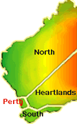
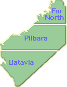
The Pilbara Holidays Destinations Towns WA
Exmouth
Exmouth
is
an
excellent
year
round
fishing
village,
for
keen
anglers.
It
has
a
terrific
beach
weather
and
is
a
popular
destination
for
tourists. The
North
West.
Cape
is
the
nearest
point
on
the
Australian
mainland
to
the
Continental
Shelf
which
explains
the
abundance
of
fish
and
other
marine
life!
Exmouth
lies
close
to
the
Ningaloo
Marine
Park,
with
its
coral
reef
providing
a
wonderful
diving
experience.
In
some
areas
the
reef
is
only
metres
from
the
shoreline.
The
Gape
Range
National
Park
with
its
rugged
scenery
and
abundant
wildlife
is
also
easily
accessed from
Exmouth.
Coral
Bay
The
small
resort
of
Coral
Bay
is
just
150km
south
of
Exmouth.
This
beautiful
bay
enjoys
a
temperate
climate
with
an
average
28C
between
April
and
November.
Beautiful
coral
formations
and
tropical
fish
located
within
the
magnificent
Ningaloo
Marine
Park
make
it
perfect
for
snorkeling.
If
you
don't
fancy
snorkeling
but
still
want
to
explore
the
reef
a
trip
on
the
glass-bottom
boat
is
recommend.
Reef
fish
and
snapper
may
be
hand
fed
from
the
shore.
As
well
as
underwater
activities,
boating,
windsurfing
and
beachcombing
can
all
be
pursued
in
Coral
Bay.
Onslow
The
original
town
of
Onslow
was
proclaimed
in
1883
and
named
after
the
then
Chief
Justice
of
Western
Australia.
It
was
located
near
the
mouth
of
the
Ashburton
River
and
served
as
a
centre
for
the
pastoral,
pearling
and
mining
industries
of
the
Ashburton District.
"Old"
Onslow
was
abandoned
in
1925,
and
re-located
in
its
present
location
on
Beadon
Bay.
It
is
becoming
increasingly
popular
for
holidaymakers
wishing
to
take
advantage
of
its
glorious
winter
climate,
beaches,
and
excellent
fishing.
Pannawonica
The
youngest
town
in
the
Shire
of
Ashburton,
founded
in
1972.
Pannawonica
is
located
due
east
of
Onlsow
on
the
western
edge
of
the
Hamersley
Ranges.
The
town
is
the
support
base
for
Robe
River
Iron
Associates,
Iron
Ore
mining
operations.
Pannawonica,
surrounded
by
pastoral
properties
is
also
the
home
of
the
only
Rodeo
held
in
the
Pilbara
Region.
The
Robe
River
Rodeo
draws
interest
and
competitors
from
all
over
the
State.
At
this
years
rodeo
there
were
competitors
from
as
far
north
as
Derby
in
the
Kimberley
Region
and
from
Perth
in
the
Southern
Region,
as
well
as
many
local
competitors
and spectators.
The
Robe
River
Rodeo
is
developing
into
one
of
the
States
richest
rodeos
and
is
an
event
that
must
not
be
missed.
Book
NOW
to
attend
the
September
1997
Rodeo.
Paraburdoo
Located
only
24
Kilometres
North
of
the
Tropic
of
Capricorn,
Paraburdoo
was
founded
in
1970
as
a
support
town
for
Hamersley
Iron's
iron
ore
mining
operations.
The
name
Paraburdoo
is
based
on
the
aboriginal
word
for
corellas,
Pirupardo,
which
means
"Meat
Feathers".
Highest
ever
recorded
temperature
is
48.9
Deg
Celcius
and
lowest
minimum
is
1.5
Deg
Celcius.
Karratha
Karratha
is
an
Aboriginal
word
meaning
"good
country".
Karratha
was
established
in
the
early
1970's
and
has
since
thrived.
The
discovery
of
large
gas
reserves
and
construction
of
the
North
West
Shelf
Gas
Project
in
the
1980s
have
led
to
further
expansion
of
the
town.
Karratha,
with
its
near
perfect
winter
temperatures
and
coastal
location
makes
for
some
spectacular
fishing.
Dampier
Dampier
takes
its
name
from
the
Dampier
Archipelago,
named
after
the
English
buccaneer/explorer
William
Dampier
who
first
visited
the
area
n
1688.
Located
in
an
attractive
setting
overlooking
Hampton
Harbour,
it
was
built
in
the
1960s
by
Hamersley
Iron
and
services
some
of
the
biggest
ships
in
the
world.
It
is
here
that
iron
ore
from
the
mines
at
Tom
Price
and
Paraburdoo
is
brought
by rail,
stockpiled
and
loaded
onto
ships
for
export.
Dampier
Salt
also
use
the
shipping
facilities
at
Dampier
to
export
salt
harvested
from
nearby
pans.
Wickham
Wickham
is
the
sister
town
to
Pannawonica,
and
it
is
here
that
iron
ore
mined
at
Pannawonica
is
processed
and
exported
to
nearby
Cape
Lambert.
The
wharf
at
Cape
Lambert
is
one
of
the
highest
and
longest
open
ocean
wharves
in
Australia.
Tom
Price
The
huge
iron
ore
deposit
now
known
as
Mt
Tom
Price
was
discovered
in
1962,
following
which
Hamersley
Iron
Pty
Ltd
was
formed.
The
construction
of
a
mine
in
two
towns
(Tom
Price
and
Dampier),
a
railway
between
the
two
and
a
port
at Dampier
followed.
The
proximity
of
the
town
to
the
spectacular
Hamersley
Range
and
an
opportunity
to
view
the
open
cut
mining
operation
make
the
town
a
popular
stopping
point.
Port
Hedland
Once
an
old
pearling
port,
Port
Hedland
is
now
one
of
the
largest
ports
by
tonnage
in
the
world.
The
town
revolves
around
the
mining
and
shipping
of
the
Pilbara's
most
valuable
commodity,
iron
ore.
Port
Hedland
is
the
international
gateway
to
unique
inland
attractions.
In
1996
Port
Hedland
will
be
celebrating
its
Centenary
(1896-1996)
with
a
number
of
special
events.
Marble
Bar
Alluvial
gold
was
discovered
in
the
area
in
1891
by
Francis
Jenkins
and
party,
and
the
town
of
Marble
Bar
declared
in
1893.
Marble
Bar
is
widely
known
as
the
hottest
town
in
Australia
due
to
its
consistently
high
temperatures.
It
holds
a
record
of
160
consecutive
days
of
century
plus
heat
(Degrees
F)
set
in
1923/24.
Newman
The
town
takes
its
name
from
nearby
Mt
Newman,
named
in
honour
of
A.W.
Newman,
an
early
explorer
who
died
of
typhoid
just
before
reaching
the
area
in
1896.
Newman
was
built
by
Mt
Newman
Mining
Company,
now
BHP
Iron
Ore,
to
house
its
employees
involved
in
the
mining
of
iron
ore.
BHP
Iron
Ore
sends
ore
from
the
mine
to
its
port
facilities
in
Port
Hedland
via
a
426
km
railroad.
|